
Tugna:Rouen France-Conseil-Régional-de-Haute-Normandie-01.jpg

Afaylu aneṣli (3 890 × 2 621 pixel, tiddi n ufaylu: 6,56 MB/MO, anaw n MIME: image/jpeg)
Agzul
| Aglam |
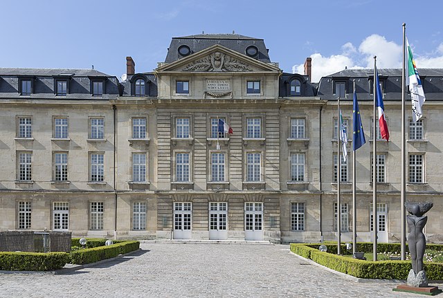
English: Rouen, France: Conseil Régional de Haute-Normandie |
||||||
| Azemz | |||||||
| Aɣbalu | Amahil udmawan | ||||||
| Ameskar | CEphoto, Uwe Aranas | ||||||
| Tasiregt (Tulsa n useqdec n ufaylu-agi) |
|
||||||
| Tinekfit (imposé par la licence) | Photo by CEphoto, Uwe Aranas / | ||||||


| Position de l'objet | | Voir cet endroit et d’autres images sur : OpenStreetMap |
|---|
|
|
Do not upload new revisions over this file version without my explicit consent. Instead, use the possibility to upload a new version under a new name and tag it as a derivate or extract of this file. |

Cette image a été promue au rang d'image de qualité d'après les critères du Guide des images.
|
Turagt
- Ɣuṛ-k tilelli:
- i beṭṭu – akken ad tneɣleḍ, ad tzuzreḍ neɣ ad tebḍuḍ amahil-agi
- i uṣeggem – i uṣeggem n umahil
- Ddaw n tiwtilin-agi:
- bab – Yessefk ad d-bedreḍ isem n umeskar aneṣli s wudem yettwammlen sɣuṛ ameskar n umahil neɣ bab n izerfan i k-imudden tasiregt (mačči s wudem yemmalen am akken yettmuddu-yak afus neɣ yeqbel aseqdec-it n umahil).
- bḍut akken yella – Ma tbeddleḍ, teskelteḍ, neɣ tebniḍ ɣef umahil-agi, yessefk ad tezzuzreḍ amahil i d-yeffɣen ɣas ddaw n turagt-nni neɣ turagt icuban ɣuṛ-s.
Amazray n ufaylu
Senned ɣef yiwen azmez d usrag iwakken ad ẓṛeḍ afaylu aken yella deg imir nni.
| Azemz/Ssaɛa | Aqmamaḍ | Iseggiwen | Amseqdac | Awennit | |
|---|---|---|---|---|---|
| Lux a | 9 Ctember 2014 à 21:32 | | 3 890 × 2 621 (6,56 MB/MO) | Cccefalon | {{Information |Description={{en|1=Rouen, France: Conseil Régional de Haute-Normandie}} |Source={{own}} |Date=2014-04-19 |author=CEphoto, Uwe Aranas |permission= |other_versions= |other_fields={{User:Cccefalon/attribution}} {{Object... |
Aseqdec n ufaylu
Asebter agi teseqdac afaylu agi :
Aseqdec n ufaylu amatu
Iwikiyen-agi-nniḍen seqdacen afaylu-agi:
- Aseqdec ɣef ar.wikipedia.org
- Aseqdec ɣef az.wikipedia.org
- Aseqdec ɣef ca.wikipedia.org
- Aseqdec ɣef ce.wikipedia.org
- Aseqdec ɣef cs.wikipedia.org
- Aseqdec ɣef cy.wikipedia.org
- Aseqdec ɣef diq.wikipedia.org
- Aseqdec ɣef eo.wikipedia.org
- Aseqdec ɣef es.wikipedia.org
- Aseqdec ɣef fi.wikipedia.org
- Aseqdec ɣef fr.wikipedia.org
- Aseqdec ɣef fr.wikinews.org
- Aseqdec ɣef fr.wikivoyage.org
- Aseqdec ɣef gl.wikipedia.org
- Aseqdec ɣef he.wikipedia.org
- Aseqdec ɣef ku.wikipedia.org
- Aseqdec ɣef no.wikipedia.org
- Aseqdec ɣef oc.wikipedia.org
- Aseqdec ɣef os.wikipedia.org
- Aseqdec ɣef pl.wikipedia.org
- Aseqdec ɣef sl.wikipedia.org
- Aseqdec ɣef sr.wikipedia.org
- Aseqdec ɣef uk.wikipedia.org
- Aseqdec ɣef vec.wikipedia.org
- Aseqdec ɣef vi.wikipedia.org
- Aseqdec ɣef www.wikidata.org