Tugna:The Blue Marble (remastered).jpg
Le contenu de la page n’est pas pris en charge dans d’autres langues.
Si Wikipedia, tasanayt tilellit.

Afaylu aneṣli(3 000 × 3 000 pixel, tiddi n ufaylu: 5,69 MB/MO, anaw n MIME: image/jpeg)

Afaylu agi yusad seg : Wikimedia Commons. Ahat yeseqdec deg isenfaṛen nniḍen. Aglam-is ɣef asebter n aglam ye beqqeḍ ddaw-agi.


Agzul

La Bille bleue  wikidata:Q202014 reasonator:Q202014
Imseknew
NASA/Apollo 17 crew; taken by either Harrison Schmitt or Ron Evans
image of artwork listed in title parameter on this page
Titre
The Blue Marble
Amur seg Apollo 17 Éditer sur Wikidata
Type d'objet photographie Éditer sur Wikidata
Tawsit astrophotographie Éditer sur Wikidata
Aglam
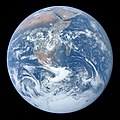
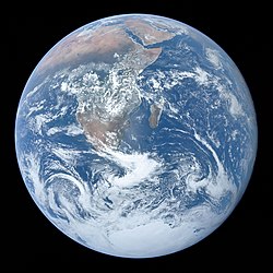
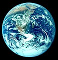
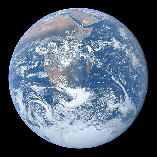
Full disk view of the Earth taken on December 7, 1972, by the crew of the Apollo 17 spacecraft en route to the Moon at a distance of about 29,400 kilometres (18,300 mi). It shows Africa, Antarctica, and the Arabian Peninsula.
Azemz 7 Duǧember 1972
date QS:P571,+1972-12-07T00:00:00Z/11
Technique / matériaux 1 photograph: Hasselblad 500EL, Zeiss Planar 80 mm f/2.8 and 70mm Kodak Ektachrome film of type SO-368
Cette image ou vidéo a été cataloguée par le
Johnson Space Center
de la
National Aeronautics and Space Administration
(NASA) des États-Unis sous Photo ID : AS17-148-22727.

Ce bandeau n’indique rien sur le statut de l’œuvre au regard du droit d'auteur. Un bandeau de droit d’auteur est requis. Voir Commons:À propos des licences pour plus d’informations.
Autres langues :
Notes The end of most film magazines used on the Apollo missions include a photograph, presumably taken on earth, of a "KODAK Color Control Patch" on a chart containing mission and camera data. This color chart was used to calibrate the above photograph to better approximate real-world colors.
Earth disk center rough coordinates: 26°19’49”S 37°25’13”E
Références https://tothemoon.ser.asu.edu/gallery/Apollo/17/Hasselblad%20500EL%2070%20mm
Aɣbalu http://tothemoon.ser.asu.edu/gallery/Apollo/17/Hasselblad%20500EL%2070%20mm https://www.flickr.com/photos/projectapolloarchive/21081863984/
Autres versions

[beddel]

Other versions:

Derivative works:

Position de l'objet26° 19′ 49″ S, 37° 25′ 13″ E Kartographer map based on OpenStreetMap.Voir cet endroit et d’autres images sur : OpenStreetMapinfo

Turagt

Public domain Ce fichier provient de la NASA. Sauf exception, les documents créés par la NASA ne sont pas soumis à copyright. Pour plus d'informations, voir la politique de copyright de la NASA.
Attention :

Légendes

Ajoutez en une ligne la description de ce que représente ce fichier
A full disk of the Earth, centered on the sea off Mozambique, as taken by the crew of Apollo 17 on 7 December 1972, from 29,400 km (18,300 mi) above. Africa, Southwest Asia and Antarctica are shown.

Éléments décrits dans ce fichier

igellem

La Bille bleue Tafransist

Azemz n ubeddi d unulfu : 7 Duǧember 1972

Apollo 17 Tafransist

type MIME Tafransist

image/jpeg

largeur Tafransist

3 000 pixel

hauteur Tafransist

3 000 pixel

format 1/1 Tafransist

couleur Tafransist

7 Duǧember 1972

5 969 721 octet

somme de contrôle Tafransist

6ffb103228140aac1c7977b004b7d93a

méthode de détermination Tafransist : MD5 Tafransist

964dc6dc213994404a37486cc306a12a690804ab

méthode de détermination Tafransist : SHA-1 Tafransist

e156f6b91e809d853ebf95e50546cf9767119b2f7ae66057514d1c9b

méthode de détermination Tafransist : SHA-224 Taglizit

e42f2650cd861c9f79c8ac6342adf465a11385a5f2d92b9db8b23962e85b06bc

méthode de détermination Tafransist : SHA-256 Taglizit

286f6c0809d0f86e425e0e827b9dddfa47f3a90285cf747b790dd87d8bddcd27068e896cdfddb3eafd40f94c07758ef8

méthode de détermination Tafransist : SHA-384 Taglizit

ea79d861354ed3d6845d470a165073b5679f1b05b2d7e14fc7bf900185d0132955db7d48456fc4c5a3c03447460c4f448f25ab39c2ff28f1b8a8eeb02c7b9e2c

méthode de détermination Tafransist : SHA-512 Taglizit

26°S, 37°E

26°19'49.001"S, 37°25'13.001"E

Amazray n ufaylu

Senned ɣef yiwen azmez d usrag iwakken ad ẓṛeḍ afaylu aken yella deg imir nni.

Azemz/SsaɛaAqmamaḍIseggiwenAmseqdacAwennit
Lux a26 Fuṛaṛ 2022 à 14:12Tugna tamectuḥt i lqem n 26 Fuṛaṛ 2022 à 14:123 000 × 3 000 (5,69 MB/MO)CactiStaccingCranecropped by 2 pixels to get a perfect 3000 by 3000
16 Fuṛaṛ 2022 à 00:59Tugna tamectuḥt i lqem n 16 Fuṛaṛ 2022 à 00:593 000 × 3 002 (5,3 MB/MO)Aaron1a12Added slight tilt as published by NASA
15 Fuṛaṛ 2022 à 23:22Tugna tamectuḥt i lqem n 15 Fuṛaṛ 2022 à 23:223 000 × 3 002 (4,91 MB/MO)Aaron1a12EV lowered
4 Fuṛaṛ 2022 à 21:36Tugna tamectuḥt i lqem n 4 Fuṛaṛ 2022 à 21:363 000 × 3 002 (5,23 MB/MO)Aaron1a12Uploaded a work by The Crew of Apollo 17 from NASA/JSC/ASU with UploadWizard

Ulaḥedd seg isebtar sɛan azday ar afaylu-agi.

Aseqdec n ufaylu amatu

Iwikiyen-agi-nniḍen seqdacen afaylu-agi:

Wali l’utilisation globale n ufaylu-agi.

Adferisefka