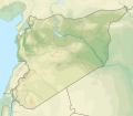
Tugna:Syria physical location map.svg

Taille de cet aperçu PNG pour ce fichier SVG : 685 × 599 iferdisen n tugna. Tibuda nniḍen : 274 × 240 iferdisen n tugna | 549 × 480 iferdisen n tugna | 878 × 768 iferdisen n tugna | 1 170 × 1 024 iferdisen n tugna | 2 340 × 2 048 iferdisen n tugna | 921 × 806 iferdisen n tugna.
Afaylu aneṣli (Afaylu SVG, tabadut n 921 × 806 pixel, lqedd : 972 KB/KO)
Amazray n ufaylu
Senned ɣef yiwen azmez d usrag iwakken ad ẓṛeḍ afaylu aken yella deg imir nni.
| Azemz/Ssaɛa | Aqmamaḍ | Iseggiwen | Amseqdac | Awennit | |
|---|---|---|---|---|---|
| Lux a | 18 Wamber 2022 à 14:07 |  | 921 × 806 (972 KB/KO) | GrandEscogriffe | more correct N/S stretching |
| 23 Yulyu 2012 à 20:40 |  | 921 × 761 (788 KB/KO) | NordNordWest | == {{int:filedesc}} == {{Information |Description={{de|Physische Positionskarte von Syrien. De-facto-Situation.}} Quadratische Plattkarte, N-S-Streckung 115 %. Geographische Begrenzung der Karte: * N: 37.6° N * S: 32.0° N * W: 34.9... |
Aseqdec n ufaylu
Asebter agi teseqdac afaylu agi :
Aseqdec n ufaylu amatu
Iwikiyen-agi-nniḍen seqdacen afaylu-agi:
- Aseqdec ɣef als.wikipedia.org
- Aseqdec ɣef ar.wikipedia.org
- نهر السن
- بلودان
- الزبداني
- قالب:خريطة مواقع سوريا
- زلزال حلب (1138)
- بحيرة زرزر
- بحيرة قطينة
- مضايا
- زلزال حماة 1157
- وحدة:Location map/data/Syria
- مستخدم:عبد المؤمن/مسودات/خرائط/الشام
- قائمة الصحفيين القتلى في سوريا
- وحدة:Location map/data/Syria/شرح
- الشعيطات
- الخط الزمني للحرب الأهلية السورية (سبتمبر–ديسمبر 2019)
- الخط الزمني للحرب الأهلية السورية (يناير–أبريل 2020)
- الأغاني الحورية
- رقية حسن محمد
- الانتخابات المحلية في الإدارة الذاتية لشمال وشرق سوريا 2015
- الخط الزمني للحرب الأهلية السورية (2022)
- زلزال قهرمان مرعش 2023
- زلزال حلب 1822
- زلزال سوريا 1170
- زلزال سوريا 1344
- زلزال اللاذقية 1796
- زلزال سوريا 1202
- زلزال الساحل السوري 859
- زلزال أنطاكية 526
- زلزال أميك 1872
- Aseqdec ɣef arz.wikipedia.org
- Aseqdec ɣef ast.wikipedia.org
- Aseqdec ɣef av.wikipedia.org
- Aseqdec ɣef azb.wikipedia.org
- Aseqdec ɣef az.wikipedia.org
- Aseqdec ɣef ba.wikipedia.org
Wali l’utilisation globale n ufaylu-agi.

