
Tugna:Sweden location map.svg

Taille de cet aperçu PNG pour ce fichier SVG : 311 × 599 iferdisen n tugna. Tibuda nniḍen : 124 × 240 iferdisen n tugna | 249 × 480 iferdisen n tugna | 399 × 768 iferdisen n tugna | 532 × 1 024 iferdisen n tugna | 1 064 × 2 048 iferdisen n tugna | 954 × 1 836 iferdisen n tugna.
Afaylu aneṣli (Afaylu SVG, tabadut n 954 × 1 836 pixel, lqedd : 2,03 MB/MO)
Agzul
| Aglam |
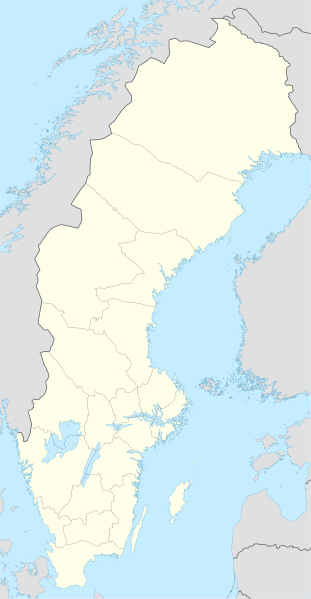
Deutsch: Positionskarte von Schweden
Quadratische Plattkarte, N-S-Streckung 214,7895 %. Geographische Begrenzung der Karte:
English: Location map of Sweden
Equirectangular projection, N/S stretching 214,7895 %. Geographic limits of the map:
|
||
| Azemz | |||
| Aɣbalu | own work, using United States National Imagery and Mapping Agency data | ||
| Ameskar | NordNordWest | ||
| Autres versions |
Derivative works of this file:
|
||
| SVG information |
|


Turagt
Moi, en tant que détenteur des droits d’auteur sur cette œuvre, je la publie sous les licences suivantes :

|
Ɣuṛ-k tasiregt akken ad tneɣleḍ, ad tzuzreḍ neɣ ad tesnifleḍ isemli-agi akken yella di tewtilin n GNU Free Documentation License lqem 1.2 neq yal lqem amaynut i d-yeffɣen sɣuṛ Free Software Foundation, s war abeddel di tgezmiyin, s war aḍris deg usebter amenzu n tdulineɣ s war aḍris deg usebter aneggaru n tduli. Amedya n turagt yedda deg tgezmi ittusemman GNU Free Documentation License. |
Afaylu-agi yella ddaw n tewtilin n turagt Creative Commons Attribution-Share Alike 3.0 Unported.
- Ɣuṛ-k tilelli:
- i beṭṭu – akken ad tneɣleḍ, ad tzuzreḍ neɣ ad tebḍuḍ amahil-agi
- i uṣeggem – i uṣeggem n umahil
- Ddaw n tiwtilin-agi:
- bab – Yessefk ad d-bedreḍ isem n umeskar aneṣli s wudem yettwammlen sɣuṛ ameskar n umahil neɣ bab n izerfan i k-imudden tasiregt (mačči s wudem yemmalen am akken yettmuddu-yak afus neɣ yeqbel aseqdec-it n umahil).
- bḍut akken yella – Ma tbeddleḍ, teskelteḍ, neɣ tebniḍ ɣef umahil-agi, yessefk ad tezzuzreḍ amahil i d-yeffɣen ɣas ddaw n turagt-nni neɣ turagt icuban ɣuṛ-s.
Tzemreḍ ad ferneḍ yiwet seg turagin-agi.
Amazray n ufaylu
Senned ɣef yiwen azmez d usrag iwakken ad ẓṛeḍ afaylu aken yella deg imir nni.
| Azemz/Ssaɛa | Aqmamaḍ | Iseggiwen | Amseqdac | Awennit | |
|---|---|---|---|---|---|
| Lux a | 20 Meɣres 2023 à 23:26 | | 954 × 1 836 (2,03 MB/MO) | HCa | Reverted to version as of 18:28, 15 July 2008 (UTC) |
| 1 Wamber 2015 à 06:45 |  | 842 × 1 837 (1,01 MB/MO) | Larske | Correction of border between Västra Götalands län and Jönköpings län. Habo municipality and Mullsjö municipality belong to Jönköpings län. | |
| 4 Ɣuct 2011 à 17:11 |  | 842 × 1 837 (981 KB/KO) | NordNordWest | upd | |
| 27 Yennayer 2009 à 09:24 |  | 954 × 1 837 (2,74 MB/MO) | Erik Frohne | Added missing border Scania-Blekinge Category:Location maps of Sweden | |
| 29 Ɣuct 2008 à 08:22 |  | 954 × 1 837 (2,74 MB/MO) | NordNordWest | ||
| 29 Ɣuct 2008 à 08:18 |  | 954 × 1 837 (1,46 MB/MO) | NordNordWest | ||
| 30 Yulyu 2008 à 11:32 |  | 954 × 1 836 (1,46 MB/MO) | NordNordWest | optimized | |
| 15 Yulyu 2008 à 18:28 |  | 954 × 1 836 (2,03 MB/MO) | NordNordWest | {{Information |Description= {{de|Positionskarte von Schweden}} Quadratische Plattkarte, N-S-Streckung 190 %. Geographische Begrenzung der Karte: * N: 69.5° N * S: 55.1° N * W: 10.4° O * O: 24.6° O {{en|Location map of [[:en:Sweden|Swe |
Aseqdec n ufaylu
Ulaḥedd seg isebtar sɛan azday ar afaylu-agi.
Aseqdec n ufaylu amatu
Iwikiyen-agi-nniḍen seqdacen afaylu-agi:
- Aseqdec ɣef af.wikipedia.org
- Aseqdec ɣef als.wikipedia.org
- Aseqdec ɣef am.wikipedia.org
- Aseqdec ɣef an.wikipedia.org
- Aseqdec ɣef ar.wikipedia.org
- Aseqdec ɣef arz.wikipedia.org
- Aseqdec ɣef ast.wikipedia.org
Wali l’utilisation globale n ufaylu-agi.