
Tugna:Morocco relief location map.jpg

Tiddi n azaraskan agi : 737 × 600 iferdisen n tugna. Tibuda nniḍen : 295 × 240 iferdisen n tugna | 590 × 480 iferdisen n tugna | 944 × 768 iferdisen n tugna | 1 223 × 995 iferdisen n tugna.
Afaylu aneṣli (1 223 × 995 pixel, tiddi n ufaylu: 265 KB/KO, anaw n MIME: image/jpeg)
Agzul
| Aglam |
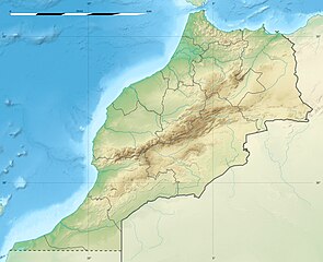
English: Blank physical map of Morocco, for geo-location purposes.
Français : Carte physique vierge du Maroc, destinée à la géolocalisation. Scale: 1:4,000,000 (precision: 1,000 m)
Geographic limits of the map:
|
||
| Azemz | 2009-11, updated 2017-02 | ||
| Aɣbalu |
Amahil udmawan
|
||
| Ameskar | Eric Gaba (Sting - fr:Sting) | ||
| Tasiregt (Tulsa n useqdec n ufaylu-agi) |
|
||
| Autres versions |
|

| Lieu de la prise de vue | | Voir cet endroit et d’autres images sur : OpenStreetMap |
|---|
Turagt
Moi, en tant que détenteur des droits d’auteur sur cette œuvre, je la publie sous les licences suivantes :
Afaylu-agi yella ddaw n tewtilin n turagt Creative Commons Attribution-Share Alike 3.0 Unported.
- Ɣuṛ-k tilelli:
- i beṭṭu – akken ad tneɣleḍ, ad tzuzreḍ neɣ ad tebḍuḍ amahil-agi
- i uṣeggem – i uṣeggem n umahil
- Ddaw n tiwtilin-agi:
- bab – Yessefk ad d-bedreḍ isem n umeskar aneṣli s wudem yettwammlen sɣuṛ ameskar n umahil neɣ bab n izerfan i k-imudden tasiregt (mačči s wudem yemmalen am akken yettmuddu-yak afus neɣ yeqbel aseqdec-it n umahil).
- bḍut akken yella – Ma tbeddleḍ, teskelteḍ, neɣ tebniḍ ɣef umahil-agi, yessefk ad tezzuzreḍ amahil i d-yeffɣen ɣas ddaw n turagt-nni neɣ turagt icuban ɣuṛ-s.

|
Ɣuṛ-k tasiregt akken ad tneɣleḍ, ad tzuzreḍ neɣ ad tesnifleḍ isemli-agi akken yella di tewtilin n GNU Free Documentation License lqem 1.2 neq yal lqem amaynut i d-yeffɣen sɣuṛ Free Software Foundation, s war abeddel di tgezmiyin, s war aḍris deg usebter amenzu n tdulineɣ s war aḍris deg usebter aneggaru n tduli. Amedya n turagt yedda deg tgezmi ittusemman GNU Free Documentation License. |
Tzemreḍ ad ferneḍ yiwet seg turagin-agi.
Amazray n ufaylu
Senned ɣef yiwen azmez d usrag iwakken ad ẓṛeḍ afaylu aken yella deg imir nni.
| Azemz/Ssaɛa | Aqmamaḍ | Iseggiwen | Amseqdac | Awennit | |
|---|---|---|---|---|---|
| Lux a | 10 Fuṛaṛ 2017 à 20:55 | | 1 223 × 995 (265 KB/KO) | Sting | Updated regions borders as since 2015 |
| 19 Yulyu 2010 à 13:11 |  | 1 223 × 995 (234 KB/KO) | Sting | Color profile | |
| 21 Wamber 2009 à 20:31 |  | 1 223 × 995 (240 KB/KO) | Sting | Putting back the southern dotted boundary (regarding Western Sahara's location map) | |
| 21 Wamber 2009 à 01:23 |  | 1 223 × 995 (239 KB/KO) | Sting | Drawback for one "correction" | |
| 21 Wamber 2009 à 01:10 |  | 1 223 × 995 (240 KB/KO) | Sting | Several little corrections | |
| 21 Wamber 2009 à 00:09 |  | 1 223 × 995 (241 KB/KO) | Sting | == {{int:filedesc}} == {{Location|31|46|30|N|7|04|30|W|scale:5000000}} <br/> {{Information |Description={{en|Blank physical map of Morocco, for geo-location purposes.}} {{fr|Carte physique vierge du Maroc, destinée à la gé |
Aseqdec n ufaylu
Ulaḥedd seg isebtar sɛan azday ar afaylu-agi.
Aseqdec n ufaylu amatu
Iwikiyen-agi-nniḍen seqdacen afaylu-agi:
- Aseqdec ɣef af.wikipedia.org
- Aseqdec ɣef ar.wikipedia.org
- Aseqdec ɣef ast.wikipedia.org
- Aseqdec ɣef azb.wikipedia.org
- Aseqdec ɣef az.wikipedia.org
- Aseqdec ɣef ba.wikipedia.org
- Aseqdec ɣef be.wikipedia.org
- Aseqdec ɣef bg.wikipedia.org
Wali l’utilisation globale n ufaylu-agi.