
Tugna:Jamaica location map.svg

Afaylu aneṣli (Afaylu SVG, tabadut n 1 134 × 546 pixel, lqedd : 58 KB/KO)
| Aglam |
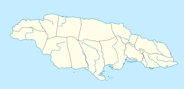
Deutsch: Positionskarte von Jamaika
Quadratische Plattkarte, N-S-Streckung 105 %. Geographische Begrenzung der Karte:
English: Location map of Jamaica
Equirectangular projection, N/S stretching 105 %. Geographic limits of the map:
|
|
| Azemz | 5 Meɣres 2009 (date de téléversement) | |
| Aɣbalu | own work, using United States National Imagery and Mapping Agency data | |
| Ameskar | NordNordWest | |
| Tasiregt (Tulsa n useqdec n ufaylu-agi) |
Ce fichier est disponible selon les termes de la licence Creative Commons Attribution – Partage dans les Mêmes Conditions 3.0 Allemagne.
 Ce fichier est disponible selon les termes de la licence Creative Commons Attribution – Partage dans les Mêmes Conditions 3.0 Allemagne.
|
|
| Autres versions |
|


|
Cette carte a été créée ou améliorée dans le Kartenwerkstatt (Atelier cartographique allemand). Vous pouvez également y proposer des cartes à améliorer.
|
Amazray n ufaylu
Senned ɣef yiwen azmez d usrag iwakken ad ẓṛeḍ afaylu aken yella deg imir nni.
| Azemz/Ssaɛa | Aqmamaḍ | Iseggiwen | Amseqdac | Awennit | |
|---|---|---|---|---|---|
| Lux a | 5 Meɣres 2009 à 09:39 | | 1 134 × 546 (58 KB/KO) | NordNordWest | {{Information |Description= {{de|Positionskarte von Jamaika}} Quadratische Plattkarte, N-S-Streckung 105 %. Geographische Begrenzung der Karte: * N: 18.7° N * S: 17.5° N * W: 78.5° W * O: 76.1° W {{en|Location map of [[:en:Jamaica|Jama |
Aseqdec n ufaylu
Ulaḥedd seg isebtar sɛan azday ar afaylu-agi.
Aseqdec n ufaylu amatu
Iwikiyen-agi-nniḍen seqdacen afaylu-agi:
- Aseqdec ɣef af.wikipedia.org
- Aseqdec ɣef an.wikipedia.org
- Aseqdec ɣef ar.wikipedia.org
- Aseqdec ɣef arz.wikipedia.org
- Aseqdec ɣef ast.wikipedia.org
- Aseqdec ɣef az.wikipedia.org
- Aseqdec ɣef be.wikipedia.org
- Aseqdec ɣef bg.wikipedia.org
- Aseqdec ɣef bn.wikipedia.org
- Aseqdec ɣef bs.wikipedia.org
- Aseqdec ɣef ca.wikipedia.org
- Aseqdec ɣef ceb.wikipedia.org
Wali l’utilisation globale n ufaylu-agi.