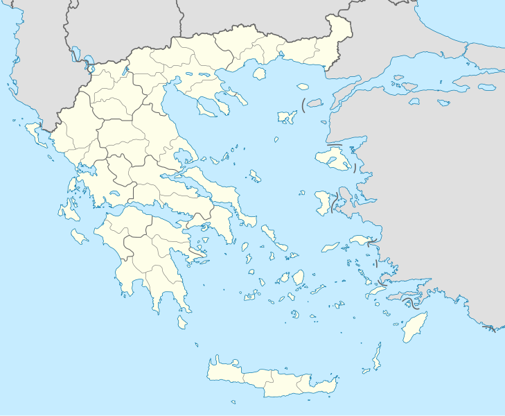
Tugna:Greece location map.svg
Le contenu de la page n’est pas pris en charge dans d’autres langues.
Si Wikipedia, tasanayt tilellit.

Afaylu aneṣli(Afaylu SVG, tabadut n 1 003 × 825 pixel, lqedd : 833 KB/KO)

Afaylu agi yusad seg : Wikimedia Commons. Ahat yeseqdec deg isenfaṛen nniḍen. Aglam-is ɣef asebter n aglam ye beqqeḍ ddaw-agi.

Agzul

Aglam
Deutsch: Positionskarte von Griechenland

Quadratische Plattkarte, N-S-Streckung 120 %. Geographische Begrenzung der Karte:

  • N: 42.0° N
  • S: 34.6° N
  • W: 19.1° O
  • O: 29.9° O
English: Location map of Greece

Equirectangular projection, N/S stretching 120 %. Geographic limits of the map:

  • N: 42.0° N
  • S: 34.6° N
  • W: 19.1° E
  • E: 29.9° E
Azemz
Aɣbalu Amahil udmawan (Texte original : own work, using United States National Imagery and Mapping Agency data)
Ameskar Lencer
Autres versions

Œuvres dérivées de ce fichier :

SVG information
InfoField
 
Le code de ce fichier SVG est valide.
 
Cette carte a été créée avec Inkscape.
Kartenwerkstatt
Cette carte a été créée ou améliorée dans le Kartenwerkstatt (Atelier cartographique allemand). Vous pouvez également y proposer des cartes à améliorer.

Turagt

Lencer, en tant que détenteur des droits d’auteur sur cette œuvre, la publie sous les licences suivantes :
GNU head Ɣuṛ-k tasiregt akken ad tneɣleḍ, ad tzuzreḍ neɣ ad tesnifleḍ isemli-agi akken yella di tewtilin n GNU Free Documentation License lqem 1.2 neq yal lqem amaynut i d-yeffɣen sɣuṛ Free Software Foundation, s war abeddel di tgezmiyin, s war aḍris deg usebter amenzu n tdulineɣ s war aḍris deg usebter aneggaru n tduli. Amedya n turagt yedda deg tgezmi ittusemman GNU Free Documentation License.
w:fr:Creative Commons
bab bḍut akken yella
Afaylu-agi yella ddaw n tewtilin n turagt Creative Commons Attribution-Share Alike 3.0 Unported.
Tinekfit: Lencer
Ɣuṛ-k tilelli:
  • i beṭṭu – akken ad tneɣleḍ, ad tzuzreḍ neɣ ad tebḍuḍ amahil-agi
  • i uṣeggem – i uṣeggem n umahil
Ddaw n tiwtilin-agi:
  • bab – Yessefk ad d-bedreḍ isem n umeskar aneṣli s wudem yettwammlen sɣuṛ ameskar n umahil neɣ bab n izerfan i k-imudden tasiregt (mačči s wudem yemmalen am akken yettmuddu-yak afus neɣ yeqbel aseqdec-it n umahil).
  • bḍut akken yella – Ma tbeddleḍ, teskelteḍ, neɣ tebniḍ ɣef umahil-agi, yessefk ad tezzuzreḍ amahil i d-yeffɣen ɣas ddaw n turagt-nni neɣ turagt icuban ɣuṛ-s.
Tzemreḍ ad ferneḍ yiwet seg turagin-agi.

Légendes

Ajoutez en une ligne la description de ce que représente ce fichier
Carte de position de la Grèce

Éléments décrits dans ce fichier

igellem

Tilos Tafransist

Dodécanèse Tafransist

Valeur sans élément de Wikidata

type MIME Tafransist

image/svg+xml

Amazray n ufaylu

Senned ɣef yiwen azmez d usrag iwakken ad ẓṛeḍ afaylu aken yella deg imir nni.

Azemz/SsaɛaAqmamaḍIseggiwenAmseqdacAwennit
Lux a10 Duǧember 2015 à 01:13Tugna tamectuḥt i lqem n 10 Duǧember 2015 à 01:131 003 × 825 (833 KB/KO)SilentResidentReverted to version as of 16:28, 11 September 2008 (UTC) The Prefectures became Regional Administrative Units with the same borders
18 Duǧember 2010 à 22:33Tugna tamectuḥt i lqem n 18 Duǧember 2010 à 22:331 003 × 825 (673 KB/KO)PitichinaccioPrefecture borders removed. The prefectures of Greece were suppressed in 2010. Präfekturgrenzen entfernt. Die griechischen Präfekturen wurde 2010 abgeschafft.
11 Ctember 2008 à 16:28Tugna tamectuḥt i lqem n 11 Ctember 2008 à 16:281 003 × 825 (833 KB/KO)Lencer{{Information |Description= |Source= |Date= |Author= |Permission= |other_versions= }}
16 Ɣuct 2008 à 12:13Tugna tamectuḥt i lqem n 16 Ɣuct 2008 à 12:131 003 × 825 (818 KB/KO)Lencer{{Information |Description= |Source= |Date= |Author= |Permission= |other_versions= }}
23 Yulyu 2008 à 18:26Tugna tamectuḥt i lqem n 23 Yulyu 2008 à 18:26869 × 715 (823 KB/KO)Lencer{{Information |Description= |Source= |Date= |Author= |Permission= |other_versions= }}
23 Yulyu 2008 à 18:11Tugna tamectuḥt i lqem n 23 Yulyu 2008 à 18:11869 × 715 (823 KB/KO)Lencer{{Information |Description= {{de|Positionskarte von Griechenland}} Quadratische Plattkarte, N-S-Streckung 120 %. Geographische Begrenzung der Karte: * N: 42.0° N * S: 34.6° N * W: 19.1° O * O: 29.9° O {{en|Location map of

Ulaḥedd seg isebtar sɛan azday ar afaylu-agi.

Aseqdec n ufaylu amatu

Adferisefka