
Tugna:Gales Bay.jpg
Tiddi n azaraskan agi : 800 × 536 iferdisen n tugna. Tibuda nniḍen : 320 × 214 iferdisen n tugna | 640 × 429 iferdisen n tugna | 1 024 × 686 iferdisen n tugna | 1 280 × 857 iferdisen n tugna.
Afaylu aneṣli (1 280 × 857 pixel, tiddi n ufaylu: 146 KB/KO, anaw n MIME: image/jpeg)
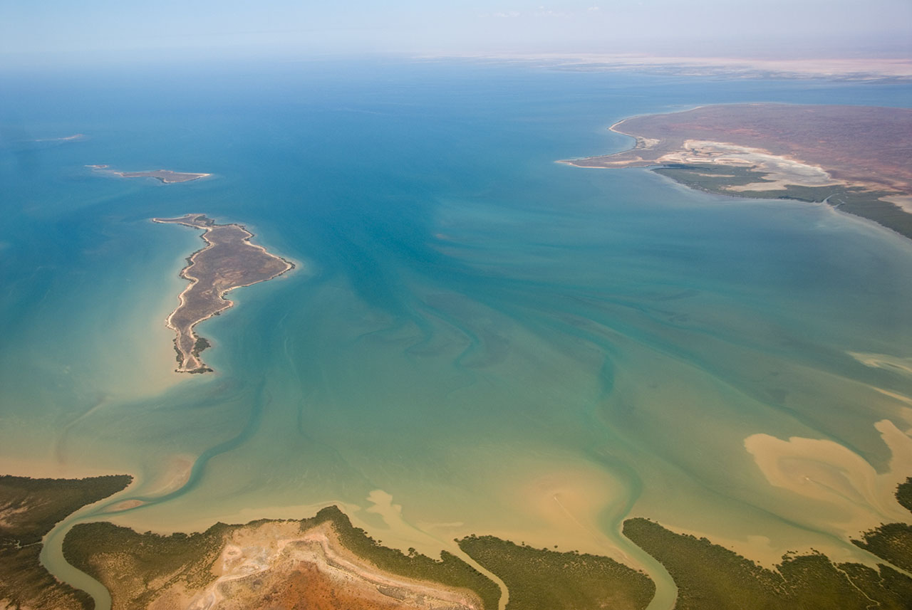
| Aglam | This is an aerial photograph of Gales Bay, a bay at the south end of Exmouth Gulf, Western Australia. The nearest foreground is Doole Island; behind it is Roberts Island; the further island is possibly Whitmore Island. The land on the right is the Sandalwood Peninsula. In the top right hand corner some of Giralia Bay can just be seen; across the top can be seen the continuing coastline of Western Australia. |
| Azemz | |
| Aɣbalu | https://www.flickr.com/photos/61952179@N00/366312114/ |
| Ameskar | Jon Hanson |
| Tasiregt (Tulsa n useqdec n ufaylu-agi) |
Ce fichier est disponible selon les termes de la licence Creative Commons Attribution – Partage dans les Mêmes Conditions 2.0 Générique
|
| Lieu de la prise de vue | | Voir cet endroit et d’autres images sur : OpenStreetMap |
|---|
| Cette image, qui provient de Flickr, a été vérifiée le 18 mai 2008 par l'administrateur ou l'utilisateur de confiance (trusted user) Kanonkas, qui a confirmé qu'à cette date, elle était publiée sur Flickr sous cette licence. |
Amazray n ufaylu
Senned ɣef yiwen azmez d usrag iwakken ad ẓṛeḍ afaylu aken yella deg imir nni.
| Azemz/Ssaɛa | Aqmamaḍ | Iseggiwen | Amseqdac | Awennit | |
|---|---|---|---|---|---|
| Lux a | 18 Mayyu 2008 à 12:20 | | 1 280 × 857 (146 KB/KO) | Hesperian | {{Information |Description=This is an aerial photograph of Gales Bay, a bay at the south end of Exmouth Gulf, Western Australia. The island in the foreground is Doole Island; behind it is Roberts Island; the further island is ''possibl |
Aseqdec n ufaylu
Ulaḥedd seg isebtar sɛan azday ar afaylu-agi.
Aseqdec n ufaylu amatu
Iwikiyen-agi-nniḍen seqdacen afaylu-agi:
- Aseqdec ɣef ar.wikipedia.org
- Aseqdec ɣef arz.wikipedia.org
- Aseqdec ɣef ceb.wikipedia.org
- Aseqdec ɣef de.wikipedia.org
- Aseqdec ɣef en.wikipedia.org
- Aseqdec ɣef fi.wiktionary.org
- Aseqdec ɣef lt.wikipedia.org
- Aseqdec ɣef nl.wikipedia.org
- Aseqdec ɣef pnb.wikipedia.org
- Aseqdec ɣef ur.wikipedia.org
- Aseqdec ɣef www.wikidata.org