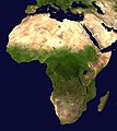
Tugna:Africa satellite orthographic.jpg

Tiddi n azaraskan agi : 534 × 600 iferdisen n tugna. Tibuda nniḍen : 214 × 240 iferdisen n tugna | 427 × 480 iferdisen n tugna | 684 × 768 iferdisen n tugna | 912 × 1 024 iferdisen n tugna | 1 624 × 1 824 iferdisen n tugna.
Afaylu aneṣli (1 624 × 1 824 pixel, tiddi n ufaylu: 535 KB/KO, anaw n MIME: image/jpeg)
Amazray n ufaylu
Senned ɣef yiwen azmez d usrag iwakken ad ẓṛeḍ afaylu aken yella deg imir nni.
| Azemz/Ssaɛa | Aqmamaḍ | Iseggiwen | Amseqdac | Awennit | |
|---|---|---|---|---|---|
| Lux a | 19 Yebrir 2005 à 09:44 |  | 1 624 × 1 824 (535 KB/KO) | Ghalas | A composed satellite photograph of Africa in orthographic projection This is NASA [http://visibleearth.nasa.gov/view_rec.php?vev1id=11656 "Blue Marble"] image applied as a texture on a sphere u |
Aseqdec n ufaylu
2 isebtaren agi teseqdacen afaylu agi :
Aseqdec n ufaylu amatu
Iwikiyen-agi-nniḍen seqdacen afaylu-agi:
- Aseqdec ɣef af.wikipedia.org
- Aseqdec ɣef ang.wikipedia.org
- Aseqdec ɣef ar.wikipedia.org
- Aseqdec ɣef ar.wikinews.org
- Aseqdec ɣef ary.wikipedia.org
- Aseqdec ɣef arz.wikipedia.org
- Aseqdec ɣef ast.wikipedia.org
- Aseqdec ɣef as.wikipedia.org
- Aseqdec ɣef awa.wikipedia.org
- Aseqdec ɣef az.wikipedia.org
- Aseqdec ɣef bat-smg.wikipedia.org
- Aseqdec ɣef ba.wikipedia.org
- Aseqdec ɣef be-tarask.wikipedia.org
- Aseqdec ɣef be.wikipedia.org
- Aseqdec ɣef bg.wikipedia.org
Wali l’utilisation globale n ufaylu-agi.


